Do-it-all small business software
Small businesses run better on Thryv. We have everything you need to communicate effectively, manage your day-to-day and grow your business — all in one place.

+25% Increase in average number of customers
+61% Increase in
appointments booked
+86% Annual revenue increase through bookings & payments
Designed to flex and scale as your needs evolve and your business grows.
Whether you want to attract new customers, scale your business, manage your day-to-day or bridge communication gaps — Thryv small business software has got you covered.
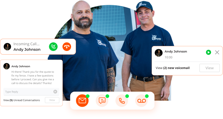
Communicate quickly, and with ease.
- One inbox for social and email
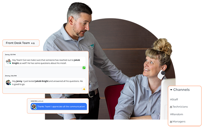
- Team Chat
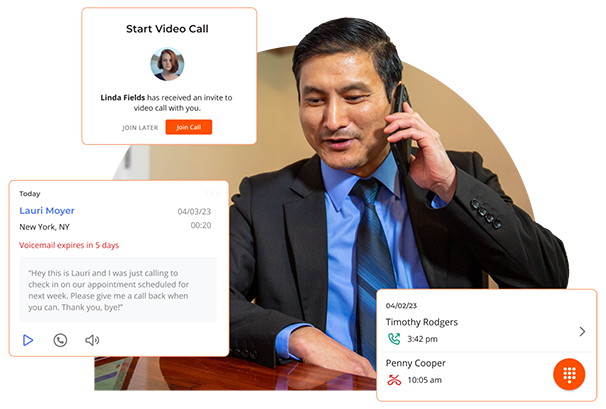
- Phone and video calls
- Transcribed voicemail
- Free Dedicated Business Line
Use forever. Free to start.
FREE
No credit card required.
Run your business & save 20 hours a week.
- Customer Database (CRM)
- Scheduling & Calendars
- Estimates, Invoices
- Social Media Management
- Documents & Files
- Online Listings & Reviews
- Email & Text Message Marketing
- Digital Payments
Starting At
$199
Per location, per month.
Grow and reach new customers.
- Advertising Campaign Management
- Landing Page Templates
- Enhanced Local Listings
- Real-Time Analytics
- AI-Powered Recommendations
- Track Offline Marketing
Starting At
$199
Per location, per month.
![]()
![]()
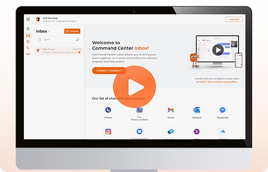
Never miss another message or customer again.
Free communication software to help you save time and resources while keeping client and team information organised.
![]()
![]()
Take the busy work out of running your business.
Small business management software to help you streamline your day-to-day, get paid fast, and effortlessly communicate with customers.
Industry recognised, client adored.
Thryv has helped over 66,000+ small businesses become more productive, efficient, and organised.


See All of Thryv's Solutions >
*No credit card needed with the Basic Command Center plan.
See why small businesses love Thryv.
“It was a great start to working with Thryv. They really know what they're doing.”
Austin W. | Urban Exterior Co.
“Thryv doesn’t just make promises about growing your business—they deliver!”
Dawn S. | A Smarter Clean
“Thryv allowed us to be all mobile and have everything organized.”
Dylan E. | Ely Heating & Cooling
“Scheduling is seamless and awesome with Thryv. I’m constantly getting clients saying how professional I come across.”
Jennifer M. | PetImpact!
“Thryv is like an employee – it’s like having another person in the business to take the pressure off of us.”
Eve S. | 215 Decking
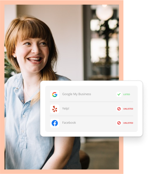
A great online presence is essential for your business– how does yours stack up?
Use our free analytics tool to see how your business compares to the competition and find out what customers are saying about you.

Learn how we will use your information
Privacy Notice: I consent to receiving a telephone call and/or electronic promotional and marketing messages from or on behalf of Thryv about its products and services. You can withdraw your consent at any time. You can contact us at [email protected], by opting-out of email marketing directly on our unsubscribe page, or at Thryv, 1155 Volunteer Pkwy, Suite 201, Bristol, TN 37620, USA . For more information on how we handle your personal information, please see our privacy policy.
1. No credit card required. Terms and conditions located at https://www.thryv.com/terms/ apply. Free plans have limited functionality. Upgraded plans with more functionality are available for a fee. See https://www.thryv.com/pricing/ for plan and pricing details. A mandatory $9 per month service & support fee will be added to any account that includes Thryv Business Center and/or Thryv Marketing Center as of September 1, 2023.
2. Applies to all paid products. A mandatory $9 per month service & support fee will be added to any account that includes Thryv Business Center and/or Thryv Marketing Center as of September 1, 2023.